Ports of Cincinnati and Northern Kentucky Re-Designation
Creating a Better Representation of our Region's Logistical Advantages
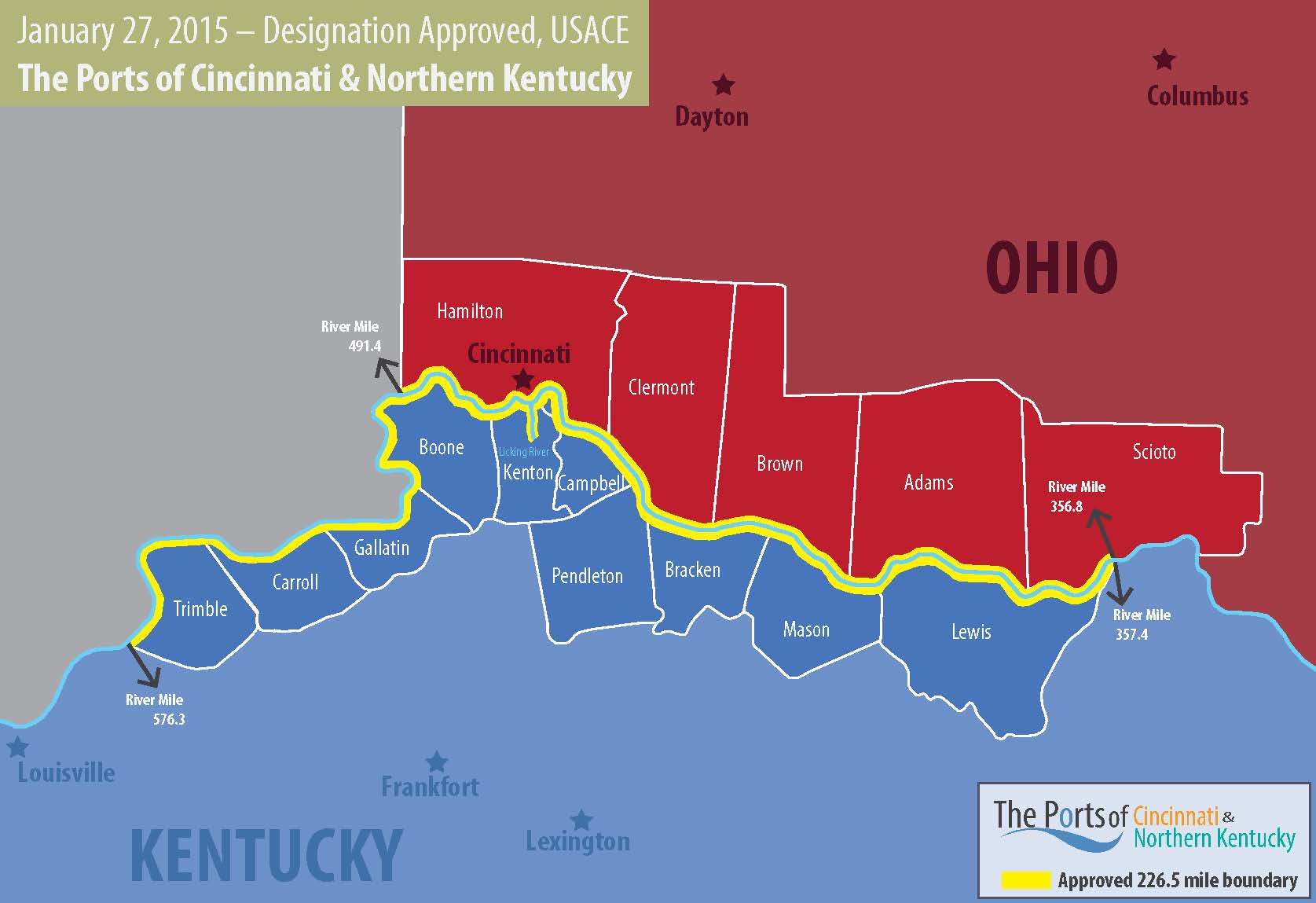
The Ports of Cincinnati & Northern Kentucky is an inland port jurisdiction that includes 226.5 miles of commercially navigable waterways of the Ohio River and Licking River in Kentucky. Its boundaries include the following 15 counties in Ohio and Kentucky:
- Ohio: Hamilton, Clermont, Brown, Adams, Scioto (part)
- Kentucky: Trimble, Carroll, Gallatin, Boone, Kenton, Campbell, Pendleton, Bracken, Mason, Lewis
In August 2012, the Port of Greater Cincinnati Development Authority and the Northern Kentucky Port Authority formally partnered to petition the U.S. Army Corps of Engineers to re-designate the then-Port of Cincinnati’s jurisdictional description from 26 miles to 226.5 miles. The two port authorities officially requested consideration of a new, regional port boundary in response to the advocacy of the Central Ohio River Business Association (CORBA), which promotes the Ohio River waterway as a vital component of the nation’s waterborne transportation system.
Impact:
The port re-designation effort was approved in January 2015, nine months after the port authorities submitted a formal proposal. The re-designation received overwhelming support from local governments, general assemblies, Governors, Federal congressional districts and private industries representing Ohio & Kentucky. This larger, established port boundary supports more than 70 active terminals, moving an estimated 48 million tons of cargo annually. The expanded boundary creates additional opportunity to expand the commodity profile and encourage economic development within the port district.
Freight traffic on inland waterways will continue to increase as businesses realize the benefits of this affordable, energy-efficient solution that can easily link with surface and air transportation facilities.
US Army Corps of Engineers documents:
Port of Cincinnati Re-Designation Petition 4.21.14 – Full Copy
USACE Approval -Redesignation 2.5.2015
Port Redesignation received for review by USACE 7.22.14
Impact:
Project Specs:
Gallery
Partners